
BETHLEHEM, Pa. — Another powerful winter storm is hitting the region, bringing concerns of widespread flooding and high winds Tuesday into Wednesday.
A flood watch already had been issued ahead of the storm. As of Tuesday evening, it was updated to a flood warning, in effect until 12:15 a.m. on Wednesday.
According to the warning from the National Weather Service, "River flood warning in effect until tomorrow afternoon for the Lehigh River at Walnutport... The river is expected to rise above flood stage late tonight to a crest of 8.6 feet tomorrow morning. It will then fall below flood stage late tomorrow morning. Flood stage is 8.0 feet... This crest compares to a previous crest of 8.8 feet on 09/09/2011."
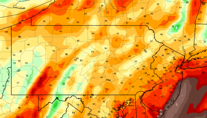
The combination of 2 to 3 inches of rain along with heavily saturated ground and melting snowpack could produce widespread flooding, the National Weather Service said.
A wind advisory also has been issued, with southeast winds at 25 to 35 mph and gusts up to 55 mph expected.

Some school districts announced early dismissals Tuesday, including Salisbury Township and Catasauqua, due to concerns about driving conditions and the potential for flooding.
Salisbury High School and Salisbury Middle School dismissed at 12:15 p.m., while the elementary school dismissed at 1:15 p.m.
In Catasauqua, Sheckler Elementary had a 1:45 p.m. dismissal, with the middle school dismissing at 1:05 p.m. and the high school dismissing at 1:15 p.m.
Precipitation
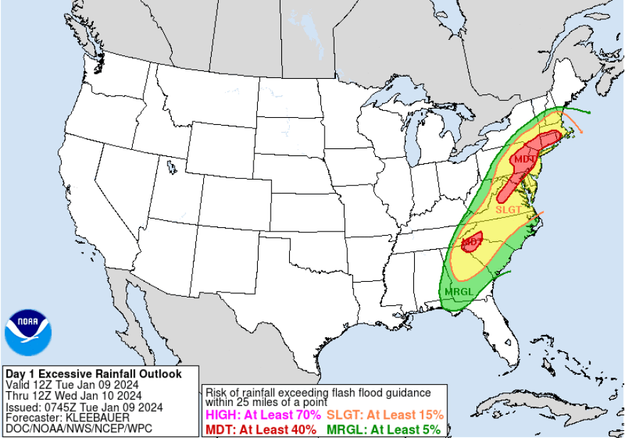
The Weather Prediction Center has placed much of the region at a moderate risk of excessive rainfall.
According to John Banghoff, a meteorologist at the NWS State College forecast office, it’s just the third January MDT ERO (moderate excessive rainfall outlook) in Pennsylvania since 2010, and the first in more than a decade.
The existing @NWSWPC Moderate Risk area (present since D5) is quite rare.
— John Banghoff (@JohnBanghoff) January 8, 2024
It's only the 3rd January MDT ERO in PA since 2010 and the first in almost a decade.
24 Jan 2010 - upgraded at 18Z Day 1
30 Jan 2013 - upgraded at 06Z Day 1 but removed thereafter
h/t @GCarbin#PAwx pic.twitter.com/sQa2j8oqZu
A moderate risk means there’s at least a 40% chance of exceeding flash flood guidance within 25 miles of any given point within the risk area, which bisects a large swath of the mid-Atlantic through the Northeast.
“This type of pattern has historically produced flooding and flash flooding concerns just based off the premise of the anomalous moisture field and heavy rainfall within the population centers located between Raleigh up to Boston,” the WPC forecast discussion said.
“The added concern of snow melt stemming from the significant winter storm from the previous 36 hours through the mid-Atlantic and Northeast only exacerbates the risk, as any additional QPE [quantitative precipitation estimate] within the time frame enhances flood concerns within the locales that received snow, as well as downstream within the river basins as the water dumps into the array of rivers and streams located within the Northeast.”
The discussion noted that was a “very tumultuous setup in regards to flooding concerns.”
River gauges from the Advanced Hydrologic Prediction Service show the Delaware River approaching minor flood stage in Easton based on the latest forecasts.
The Lehigh River is expected to reach minor flood stage in Walnutport and 'action' stage in Bethlehem.
Wind
“This is another high-impact system affecting the region,” EPAWA meteorologist Bobby Martrich said in his latest video update. “This is going to be a big deal today. It really is.”
Martrich pointed to models that showed a meridional flow – a large-scale atmospheric flow in which the north-south component is pronounced.
EPAWA's 1/9 and week ahead outlook, covering:
— Bobby Martrich | EPAWA (@epawawx) January 9, 2024
■ Today's impacts of rain/snow/wind expectations
■ Flooding threat high with power outage concerns
■ Early look at the trailing system on Friday nighthttps://t.co/1J2mwvxa2c
“That means we have everything at all levels going all the way up aligned perfectly to allow for windy conditions… and that’s going to be the problem.”
PPL Electric said on its social media channels it’s prepared to respond to any outages. Customers also can report or check the status of an outage at pplelectric.com/outage or text “OUTAGE” to “TXTPPL.”
Be prepared
The Lehigh County Emergency Management agency is warning residents to be prepared for the storm by charging devices, having water, non-perishable food, medications and batteries available.
“Let's come together as a community to stay safe and support one another through this weather event," a Facebook post said.
"Keep an eye on updates, and most importantly, take the necessary precautions to protect yourself and your loved ones.”
In a press release Tuesday, PennDOT, the Pennsylvania Emergency Management Agency and Pennsylvania Turnpike Commission also advised motorists to avoid unnecessary travel during the storm and for residents to prepare accordingly.
"It is vitally important for everyone to be weather aware and make sure they know where they keep important documents that they might need to grab quickly if they need to leave their homes, and to plan where they would go if they had to evacuate," said PEMA Director Randy Padfield.
