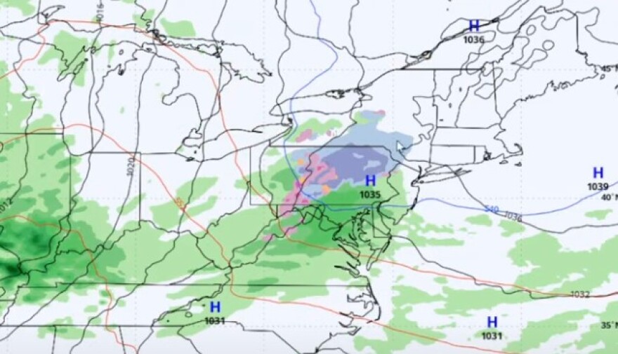
BETHLEHEM, Pa. — Forecasters say part of the weekend will potentially be "the most impactful period of the next 7 days" with possible mixed precipitation in the Lehigh Valley.
But the National Weather Service said while not much has changed with thinking in the overall pattern, “there remains considerable uncertainty with the details.”
That uncertainty comes with a system arriving Sunday night that could bring a period of snow and ice to the area before a changeover to rain.
We made it to Friday! The vast majority of the weekend is looking dry, if a bit chilly. Precip is likely to move in to the region by Sun evening. Much of the region will see all rain. But for areas near &N of I-78, the precip could start as wintry mix. https://t.co/LgidMZaLEV pic.twitter.com/01ixf4kCxM
— NWS Mount Holly (@NWS_MountHolly) December 13, 2024
The setup
According to the weather service, a weak short wave trough — a disturbance in the mid- or upper part of the atmosphere — should arrive Sunday night, followed closely behind by a warm front on Monday.
With the setup, forecasters “expect to have all the ingredients for a cold air damming scenario,” the weather services said in its latest forecast discussion.
Cold air damming takes place when a low-level cold air mass is trapped topographically. Often, the cold air is entrenched on the east side of mountainous terrain, according to NOAA, with the trapped cold air mass influencing the dynamics of the overlying air mass.
Effects on the weather with cold air damming may include cold temperatures, freezing precipitation and extensive cloud cover, but can be notoriously difficult to model.
EPAWA meteorologist Bobby Martrich said high pressure sitting over New England could help deflect a lot of the moisture, but will serve as the cold air source for wintry precipitation.
Timing
“There could be, with the onset of this precipitation coming in overnight (Sunday into Monday), some light snow and maybe some wintry mix,” Martrich said in his latest video update.
He said model runs project the cold air damming scenario affecting precipitation down through the Interstate 78 corridor in the overnight period.
Precipitation is expected to change over to rain Monday morning, but the extent and duration of any mixed precipitation still is very uncertain.
Potential amounts and impacts
Forecasters say the pattern favors very light total precipitation amounts, no matter what type of precipitation we get.
“Even for areas that see a period of wintry mix or even all snow, snow accumulation and ice accretion should be light,” the NWS forecast discussion said.
Martrich concurred, and said temperature patterns have a lot of volatility to them right now, as well.
Overall impacts for the event include the possibility of slippery conditions, primarily during the Sunday evening and overnight period before a changeover to all rain during the day Monday.


