BETHLEHEM, Pa. — Smoke and haze from wildfires in Canada again will spread across Lehigh Valley skies this week, the National Weather Service warned Monday.
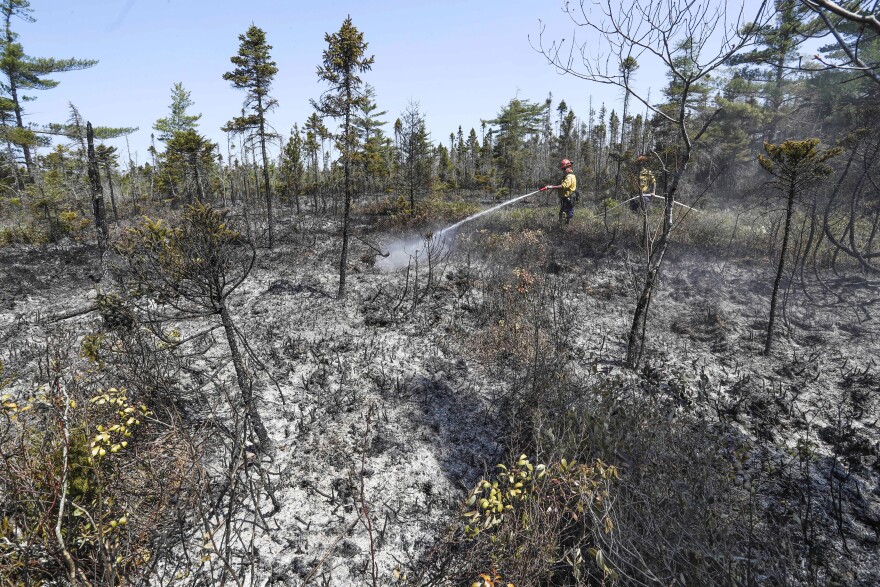
Officials say one wildfire in Canada’s Atlantic Coast province of Nova Scotia now is contained, but a second fire — the largest in Nova Scotia’s history — continues to burn out of control.
- Wildfires in Canada, including in Nova Scotia and Quebec, continue to burn
- Smoke from those fires is streaming into the United States, particularly into the Mid-Atlantic region, impacting air quality in the Lehigh Valley
- Forecasters say current indications are for smoke to remain elevated over the region this week, bringing us haze and smoky skies
While wildfires are common in parts of Canada, Nova Scotia is experiencing its worst-ever wildfire season, with nearly 200 so far this year that have burned 55,000 acres and displaced more than 25,000 people, the Associated Press reports.
New wildfires also are burning in Quebec, which has seen nearly 400 wildfires in the province this year.
The Mid-Atlantic region is remaining within a cyclonic flow — with winds swirling counterclockwise — in association with a low-pressure system centered just south of Cape Cod in New England. As a result, winds will continue to increase in our area.

How is this impacting the Lehigh Valley?
The fires continue to send rounds of smoke our way, resulting in hazy skies and unhealthy air quality.
In its morning forecast discussion Monday, the weather service said smoke will overspread our region late Monday, but near-surface smoke should be much more reduced.
“As a result, the smoke looks to be well aloft as it arrives and should make for a hazy sky once again,” the discussion said.
Near-surface vs. smoke aloft
This toggle depicts recently observed and model forecast of vertically integrated and near surface #smoke from Canadian wildfires. #AirQuality will be a concern for millions. https://t.co/MPPMT5rqnh pic.twitter.com/cFAMGMaZFU
— UW-Madison CIMSS (@UWCIMSS) June 5, 2023
Forecasters say that current indications are for smoke to remain elevated over the region this week, bringing us haze and smoky skies — though some surface haze can’t be ruled out.
While both near-surface smoke and smoke aloft (known as vertically integrated smoke) impact our air quality, the former is more impactful because people will be able to breathe it.
Smoke that is vertically integrated is in a vertical column, including high in the Earth’s atmosphere. According to NASA, that’s the smoke we notice most at sunrise and sunset because it can block sunlight and also send particles into the atmosphere that scatter the sun’s rays — and the colors that come with it.
Our wildfire risk
Dry weather and gusty winds have increased the wildfire risk across Pennsylvania, including the Lehigh Valley.
The U.S. Forest Service uses the Wildland Fire Assessment System to measure wildfire risk, closely monitoring temperatures, wind speed, relative humidity and precipitation chances to create a daily fire weather map.
The Wildland Fire Assessment System also uses a Fire Danger Rating that takes into account the various fuel types, including both live and dead fuel moisture.
According to the National Centers for Environmental Information, fuel moisture is a measure of the amount of water in a fuel (vegetation) available to a fire. When fuel moisture is high, fires do not readily ignite. When it’s low, fires will start easily and spread rapidly.
Small fuels are those less than a quarter-inch in diameter, such as grass, leaves and mulch that respond more quickly to changes in atmospheric moisture content.
Fuels that are 3 to 8 inches in diameter, such as fallen trees and brush files, take longer to adjust to moist conditions. They don't burn easily, but according to experts, if they catch fire they will generate extreme heat, often causing dangerous fire behavior.


