BETHLEHEM, Pa. — More than 71% of the United States, including the Lehigh Valley, faced abnormally dry conditions entering December.
But little by little, Mother Nature is chipping away at the deficit.
The National Weather Service said a potent system will pack a punch later Tuesday and especially Wednesday.
Expected rainfall totals of 2 to 3 inches could mark our biggest event in about four months.National Weather Service
Expected rainfall totals of 2 to 3 inches could mark our biggest event in about four months, forecasters said.
Swaths of the region wereinundated by heavy rainfall back on Aug.18, leading to flash floods and prompting water rescues.
Some areas got nearly 5 inches of rain, with 2.35 inches measured at Lehigh Valley International Airport, the area’s official climate site.
Since then, however, it's been nearly bone dry. The Allentown area holds a precipitation deficit of 6.18 inches for the year, with the past three months being its driest on record.
Overall, there's still a moderate drought in all but one state (Alaska) and the Lehigh Valley remains in severe drought, according to the U.S. Drought Monitor.
Heavy rainfall ahead
A storm system plodding our way will transition from light showers Tuesday night to heavy periods of rainfall on Wednesday, EPAWA meteorologist Bobby Martrich said in his latest video update.
“This is going to evolve into steady periods of rain here on Wednesday, and this will become heavy at times,” Martrich said.
The rainfall is expected to be heaviest Wednesday afternoon and evening as a cold front approaches, with forecasters not ruling out some rumbles of thunder possible.
In addition, strong wind gusts are expected for the second time in less than a week in the Lehigh Valley area, with the Storm Prediction Center projecting a marginal risk (1 out of 5) for severe weather.
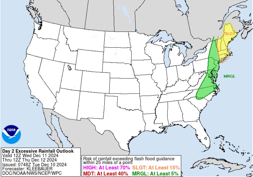
“With how dry it has been, flooding concerns are low and the Weather Prediction Center maintains a marginal (1 out of 4) risk for excessive rainfall,” the latest NWS forecast discussion said.
The discussion highlighted the main concerns as urban and poor drainage flooding and ponding on roads, along with wind gusts around 25 to 35 mph.
Cold air to follow
Temperatures are expected to plummet in the wake of Wednesday’s storm, as “cold air advection wind gusts come in behind it,” Martrich said.
We’ll see the overnight temperatures drop from the mid-40s/low-50s to the upper-20s and low-30s, along with wind chills in the 20s.
The weather service said winds will continue to be gusty Thursday and Thursday night, with temperatures holding below normal in the mid- to upper-30s.
“Wind chill readings will be about 10 degrees colder than the actual temps,” the forecast discussion said.


