BETHLEHEM, Pa. — Lehigh Valley residents had little time to brace themselves for the onslaught of heat this season, with more 90-degree days in June than the area had all last summer.
Now, in the middle of its second heat wave, the region will face “an active week in terms of weather hazards,” the National Weather Service said early Monday, with the remnants of Beryl expected to impact the area.
Heat advisories extended
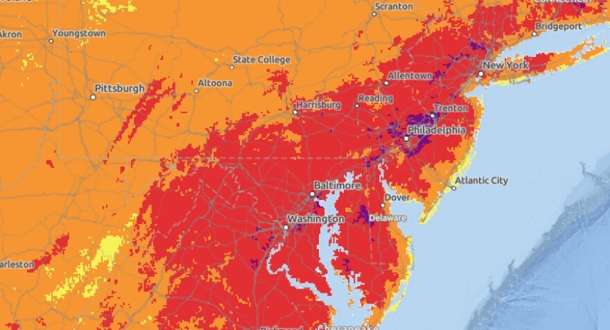
Dangerously hot and humid conditions are expected Monday and Tuesday, with the threat for excessive heat likely to continue into Wednesday, the weather service said in its initial support briefing.
“Peak heat indices on Wednesday are forecast to reach or exceed 100 degrees, and therefore an extension of this heat advisory into Wednesday is possible."NWS
A heat advisory remains in effect until 8 p.m. Tuesday, with heat index values up to 100 Monday and up to 104 expected Tuesday.
“Peak heat indices on Wednesday are forecast to reach or exceed 100 degrees, and therefore an extension of this heat advisory into Wednesday is possible,” the briefing said.
This is shaping up to be an active week in terms of weather hazards - primarily excessive heat and heavy rain threats. For the latest information, view our briefing at https://t.co/JiD09ByGTv
— NWS Mount Holly (@NWS_MountHolly) July 8, 2024
For a detailed forecast for your location, visit https://t.co/LgidMZaLEV
The sweltering temperatures come after the area pushed through eight days in the 90s in June, breaking numerous records along the way.
Another record event was reported over the weekend, with a new record low warm temperature set.
A minimum temperature of 77 degrees at Lehigh Valley International Airport on Saturday, July 6, broke the previous record warm minimum temperature of 74 set in 1999.
Beryl’s impact
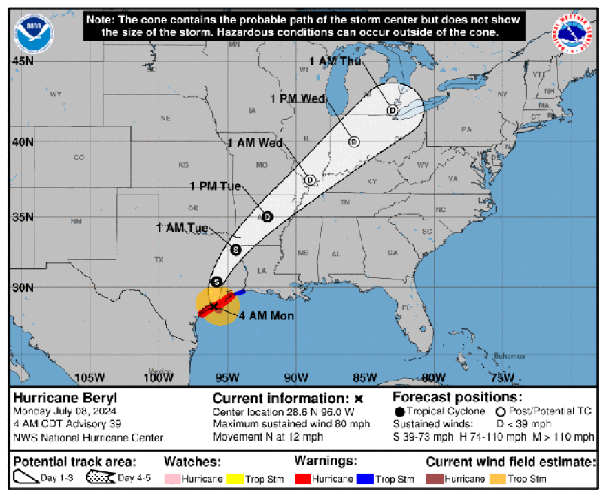
Powerful wind gusts and torrential rains slammed the Texas coast early Monday as Beryl made landfall as a Category 1 hurricane in Texas.
It’s expected to crawl across parts of the middle and upper Texas Gulf Coast and eastern Texas, then push north and begin to impact our weather later this week.
“The big story with this period is the approach of Beryl, primarily Wednesday into Thursday, resulting in an increase in thunderstorm chances,” the weather service said in its latest forecast discussion.

According to the support briefing, there is up to a 70% chance for storms Wednesday into Thursday as the remnant low of Beryl tracks northwest of our region.
“Storms during this period will be capable of heavy rain leading to flash flooding,” the weather service said, with the highest risk along and north of the Interstate 78 corridor.
According to the Weather Prediction Center's excessive rainfall outlook, there is still a fair amount of spread in the guidance with respect to the evolution and track for post-tropical Beryl, but "the flow of tropical moisture should bring the highest precipitable water anomalies into the Lower Great Lakes and Northeast during this period.
"The exact location of the heaviest rainfall will be dependent on the location of [a] frontal boundary but there is a growing signal for a broad area to be impacted by the heavy rains. A Slight Risk is in effect from northern Indiana to New Hampshire while a Marginal Risk area spans from Illinois to Maine."
Another period of storms is possible Friday continuing into Saturday, the weather service said.
"The primary hazard with this period also is heavy rain leading to flash flooding. Risk for heavy rain exists across most of the region in this period," the briefing stated.


