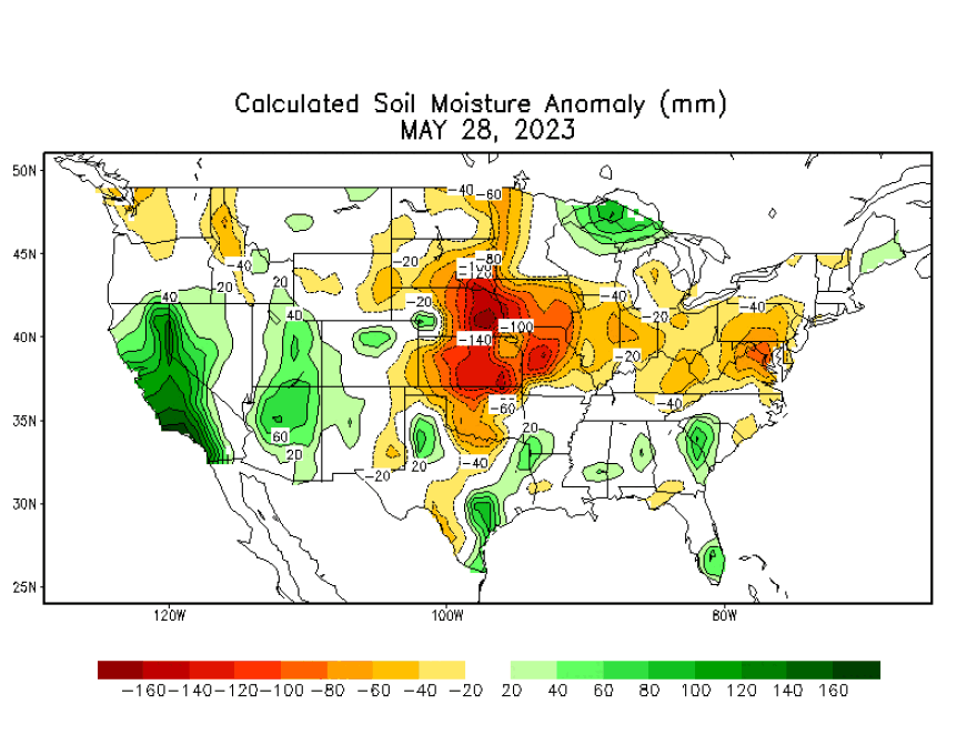
BETHLEHEM, Pa. — A beautiful May has left the Lehigh Valley searching for a drop in the bucket — a drop of rain, that is, after one of the driest months on record.
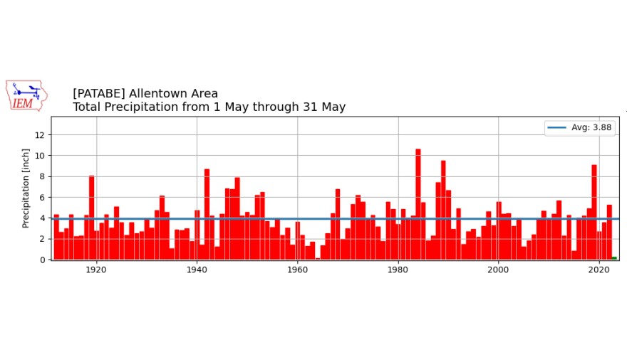
With just under a quarter-inch of rain for the month, the area will record its second-driest May ever, behind only the 0.09 inches recorded in May 1964.
Normal precipitation for the month is 3.28 inches.
- The Lehigh Valley had its second-driest May on record
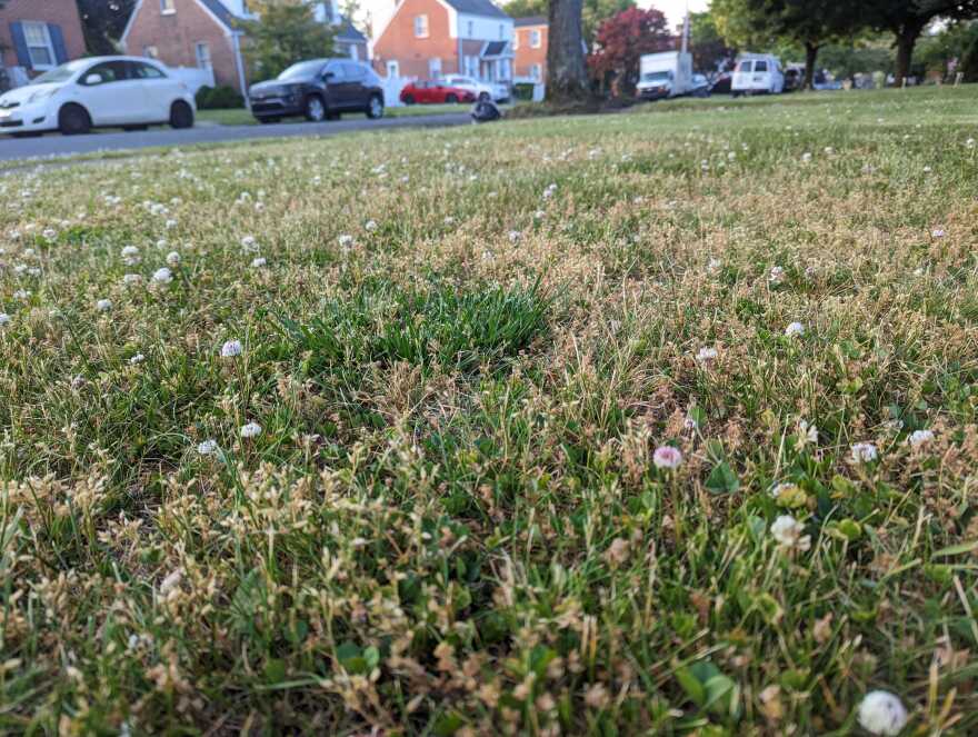
- Lawns are stressed and rivers are running low across the region
- Forecasters warn we'll continue to see drier-than-normal conditions
The National Weather Service also warned in one of its latest forecast discussions that we’ll continue to see drier-than-normal conditions, with high temperatures pushing into the upper 80s and low 90s for many areas by Friday.
“Dry weather should prevail overall with increasing temperatures through the end of the week,” Tuesday’s discussion said.

Drought ahead?
There has been no increase in drought conditions locally in the most recent update from the U.S. Drought Monitor, but that should change in the coming days.
The data cutoff for Drought Monitor maps is 8 a.m. EDT each Tuesday. The new maps, which are based on analysis of the data, are then released at 8:30 a.m. EDT each Thursday.
Parts of the region could move to abnormally dry status, though the state Department of Environmental Protection also monitors drought conditions statewide and makes its own watch and warning declarations. Currently, it has no drought watches in any of its 67 counties.
In Easton, the Delaware River was running at just 1.7 feet on Wednesday morning. The Lehigh River was at 1.56 feet in Bethlehem.

If we’re looking for a culprit for how dry it’s been, the lack of rain can be blamed on our persistently cooler-than-normal weather.
That’s because warmer air holds more moisture, so in most cases warmer temperatures and more precipitation go hand-in-hand, with the reverse also true.
Temperatures have run below average so far this month not only in the Lehigh Valley, but across much of the eastern United States.
The average monthly temperature in Allentown has been 58.5 degrees, or 3.4 degrees below average.
Overall, it’s been a dry year
Average rainfall for the area during the month is 3.8 inches, followed by June’s 3.98-inch average, July’s 4.77-inch average and August’s 4.52-inch mean.
But going into May, two of the first four months of the year had below-average precipitation. April was the exception, with 6 inches of rain, though half of it came in the final three days of the month.

Without that three-day washout, April would’ve also finished the month with below-average rainfall. Instead, it finished 2.33 inches above average.
But it followed a dry March (0.85 inches below average) and February (1.72 inches below average).
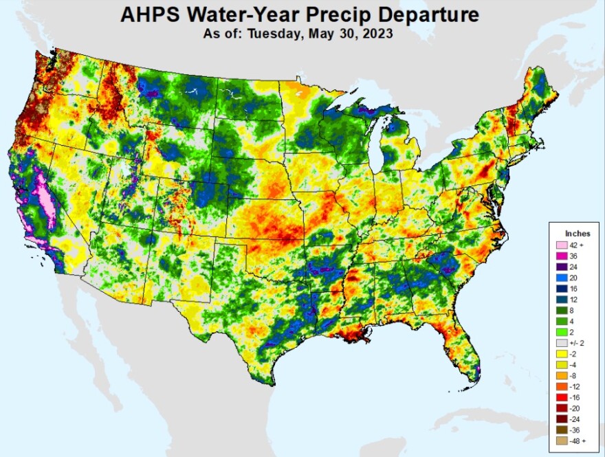
The 14.14 inches of rain that have fallen so far in 2023 is 2.23 inches below average, and it’s a similar story across the Mid-Atlantic.
Philadelphia will set a record this month for its driest May ever, with records dating to 1872. For the year, it's departure from normal is 4.33 inches of precipitation.
Rain for the weekend?
A backdoor cold front sagging down from New England will come through over the weekend, EPAWA meteorologist Bobby Martrich said in his latest video forecast.
EPAWA's 5/31 and week ahead outlook, covering:
— Bobby Martrich | EPAWA (@epawawx) May 31, 2023
■ Wildfire smoke and haze to contend with today
■ Very warm/hot temperatures late in the week
■ Backdoor cold front Saturday brings showers?https://t.co/KhcoGmPMVc
But it won't be a drought-buster, by any means.
"The question is how much precipitation we're going to have with this," Martrich said. He said he's "leaning toward less because most of the ensembles [models] are less."
The weather service also said moisture may be lacking with the front, bringing perhaps a chance of showers to the area on Saturday.


