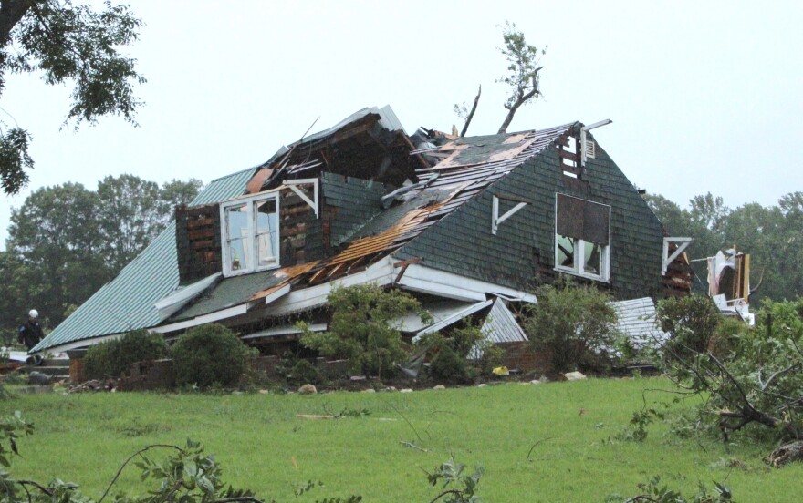
BETHLEHEM, Pa. — As Debby transitioned from a tropical storm to a post-tropical cyclone, it produced flash flooding and one confirmed tornado overnight in Delaware.
As the threat shifted north Friday, a tornado watch set to expire in the Lehigh Valley at 2 p.m. was extended until 10 p.m., with isolated damaging wind gusts up to 65 mph possible.
"As extra-tropical cyclone Debby continues moving northeastward across eastern New York this afternoon and into this evening, potential for a few tornadoes will accompany this system -- affecting areas as far east as western New England," the latest update from the Storm Prediction Center said.
A confirmed tornado occurred near Marshallton, DE this evening around 7:12 PM. We do not have any additional confirmed details at this time. If you have any reports of wind damage or flooding from northern Delaware or Chester County, PA, we certainly appreciate them! #DEwx #PAwx
— NWS Mount Holly (@NWS_MountHolly) August 8, 2024
"Just to add context to this.. for counties included in our area, the end time of 10 p.m. is way too late," EPAWA meteorologist Bobby Martrich said on X.
"For parts of NY and VT yes, but the severe threat is done by 4 p.m. in PA, and 6 p.m. in Northeast New Jersey."
With heavy rainfall rates just before 3 p.m., the National Weather Service also issued a flash flood warning in effect until 6:45 p.m.
"There is a flash flood warning in our area. If you encounter flooded roadways please turn around. It is not safe to walk or drive on flooded streets," the Allentown Fire Department said on X.
There is a flash flood warning in our area. If you encounter flooded roadways please turn around. It is not safe to walk or drive on flooded streets. pic.twitter.com/OJa8HLX7ED
— Allentown Fire Department (@AllentownFD) August 9, 2024
Debby remnants pick up the pace
Debby made landfall early Monday on the Gulf Coast of Florida as a Category 1 hurricane.
It made a second landfall early Thursday in South Carolina as a tropical storm, and transitioned to a tropical depression by Thursday afternoon — but the damage had been done.
At least seven people have died related to Debby, the Associated Press reported, including one person killed Thursday as tornadoes spawned by the storm leveled homes and damaged a school in the small town of Lucama, North Carolina.

“Expect as we go into the day today, Debby will continue to lift northward through central PA as it passes to our west while continuing to undergo extratropical transition,” the weather service said Friday morning.
While the heaviest rain will stay mainly to the west, the latest forecast discussion highlighted “widespread showers” impacting the region.
“For this reason, [we] expanded the flood watch east through the urban corridor and then on through our northern NJ counties,” the discussion said.
What are rain-wrapped tornadoes?
Tornadoes come in multiple different forms, but the danger Friday will come from the type described as “rain-wrapped.”
Such tornado is obscured by heavy rainfall, which means it’s impossible to know if a tornado is even on the ground unless verified by radar or other sources, such as a damage survey.
Rain-wrapped tornadoes are associated with supercell thunderstorms or can be embedded within squall lines — a line of intense storms.
A rain-wrapped tornado hit Allentown’s east side in August 2023. It was embedded in a QLCS, a weather acronym that stands for Quasi-Linear Convective System — a complex of thunderstorms that commonly develop and pose the threat of damaging winds and isolated tornadoes.
In that case, the tornado was embedded in a larger mesocyclone, or the rotating part of the storm.
It came while a tornado watch was in effect, but a tornado warning was never issued before the storm had touched down and lifted off again.


