
BETHLEHEM, Pa. — It turns out the groundhog was right.
A cold front will pack a punch on the first day of spring, forecasters said, warning the recent warm weather and change of season actually is not a sign of things to come.
The spring equinox officially arrived at 5:01 a.m. Thursday, along with a mild start to the day.
But storms will bring widespread rainfall, windy and cooler conditions Thursday night into Friday, according to the National Weather Service.
Separately, the Climate Prediction Center’s extended outlook suggests it’ll feel much more like winter than spring in the days ahead.
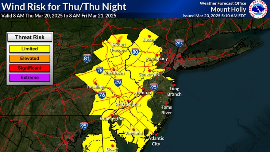
Here comes the rain, cold
While expected rainfall amounts have decreased slightly, forecasters say most locations Thursday night will end up seeing about a half-inch of rain, though localized amounts may be higher.
Precipitation is set to move in from west to east in the mid-to-late afternoon, EPAWA meteorologist Bobby Martrich said in his latest update, with heavier rainfall in the Lehigh Valley expected closer to the evening rush.
Behind the cold front, overnight lows will dip back into the 30s for most areas and into the 20s for the Poconos.
“Northwest winds will then surge behind the front overnight, with winds gusting up to 30 to 40 mph come daybreak Friday,” the weather service said in its latest forecast discussion.
The result of the front will be daytime highs about 15 degrees lower Friday compared with Thursday, and a chilly weekend ahead.
High temperatures should push into the mid- to upper 50s on Saturday, but after another cold front moves through, Sunday’s temperatures may be stuck in the upper 40s.
Below-normal temperatures
The northeastern United States will continue to be influenced by troughing in the days ahead, according to the Climate Prediction Center.
That will support “elevated probabilities for below-normal temperatures across portions of the Upper Midwest, northern Mid-Atlantic and Northeast.”
It’s a pattern that won’t seem to run out of steam — or in this case, frost? — anytime soon.
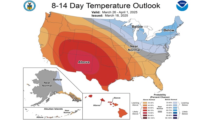
Projected daytime highs through next week won’t get out of the 50s, and may even drop back into the 40s, forecasters say.
Overnight lows also will continue to be near or below freezing for many areas.
Additionally, trends favor near- to above-normal precipitation for the region, the CPC said, noting the latest guidance is “notably wetter" compared to previous model runs.
