BETHLEHEM, Pa. — Fine particle pollution in the Lehigh Valley is highest near warehouses and highways, the most recent data from the Lehigh Valley’s $100,000 air monitoring project shows.
“It's important to remember that these are very preliminary readings over a very short period of time, just slightly more than 2 weeks,” according to the February project update. “These calculations are mostly done to assess whether we are seeing data that aligns with what we might expect to see if truck traffic is having a meaningful localized impact on air quality.”
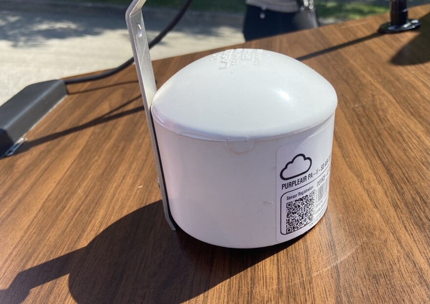
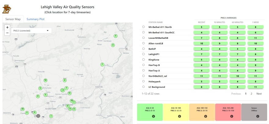
A year-long project, Lehigh Valley Breathes aims to monitor air quality amid emissions from trucking and warehousing. As part of the effort, 40 PurpleAir monitors are slated to be installed; so far, 22 appear on the Shiny App, the project’s online dashboard.
These interim readings help us to confirm that we are placing the monitors in enough of a variety of locations to collect data relevant to the project objectives.Lehigh Valley Breathes, February 2024 update
“Until we’ve completed that full cycle and had time to analyze the entire body of data, we will not be reporting any conclusions or recommendations,” officials said in the update. “These interim readings help us to confirm that we are placing the monitors in enough of a variety of locations to collect data relevant to the project objectives.”
Warehouses, highways
A two-week sampling of data collected by the project showed a variance between location and air quality across the region, according to the update.
The highest concentrations of PM 2.5 were recorded in places that are proximate to both warehouses and highways, officials said. However, a monitor sited in a rural area with high truck traffic measured higher than an urban corridor area near warehouses.

PM 2.5 are particles so small that they’re invisible to the naked eye, but are made up of a mix of chemicals that can get deep into the lungs and can cause health problems. They are measured in micrograms per cubic meter, or µg/m3.
Concentrations at monitoring sites near warehouses and highways record 9.7 and 7.8 µg/m3, respectively, data shows.
“In contrast, our urban corridor location that is near a warehouse but more distant from a highway measured an average of only 7.1 µg/m3, and our background urban corridor location that is near neither warehouses nor highway traffic measured only 6.6 µg/m3 during this same period,” according to the update.
Measurements from a monitor in a rural area with high truck traffic averaged PM 2.5 levels of 7.5 µg/m3, while an urban background site, located in a park, away from traffic and warehouses was at 6.6 µg/m3.

The World Health Organization recommends the annual average concentration of PM 2.5 should not exceed 5 µg/m3.
‘Dramatic difference’
Alongside the two-week data, officials also released a more long-term collection from air monitors at Leaser Lake, Lynn Township, Lehigh County.
The monitor does not show on the Shiny App because there is no Wi-Fi access, officials said. That data is collected on SD cards and manually transferred to the database.
The data is “the most dramatic difference to date,” officials said.
“That monitor has been in place for a much longer period of time,” according to the update. “The average PM2.5 at Leaser Lake between 9/30/23 and 1/24/24 was 3.6 µg/m3, a reading even lower than the World Health Organization’s recommended annual average concentration of 5 µg/m3.
“Other monitors that have been in place for the same period of time have much higher averages.”
They include:
- LehighIP1: 8.3 g/m3 – urban corridor, non-proximate to highway, low traffic
- CharterArtsSS: 9.6 g/m3 – urban corridor, non-proximate to highway, high traffic
- Hellertown-BIP-78: 9.3 g/m3 – urban corridor, proximate to warehouse
- LowerMtBethelSB: 7.6 g/m3 - rural, proximate to road, high traffic
For more information, visit the Lehigh County or Northampton County website for Lehigh Valley Breathes.


