
BETHLEHEM, Pa. — Sunday marked the official start of meteorological fall, bringing crisp autumn air and dry weather to the Lehigh Valley.
The average high so far this week has been 78 degrees, with the average low at 55. That brings the monthly average to 66.7, or 4 degrees below normal.
So far, those temperatures are more typical of early to mid- October, according to the National Weather Service.
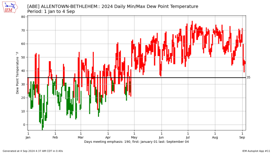
What’s more, the pattern has resulted in the driest air mass we've experienced since the back half of April, when the dew point was in the 20s and 30s.
What’s driving the pattern?
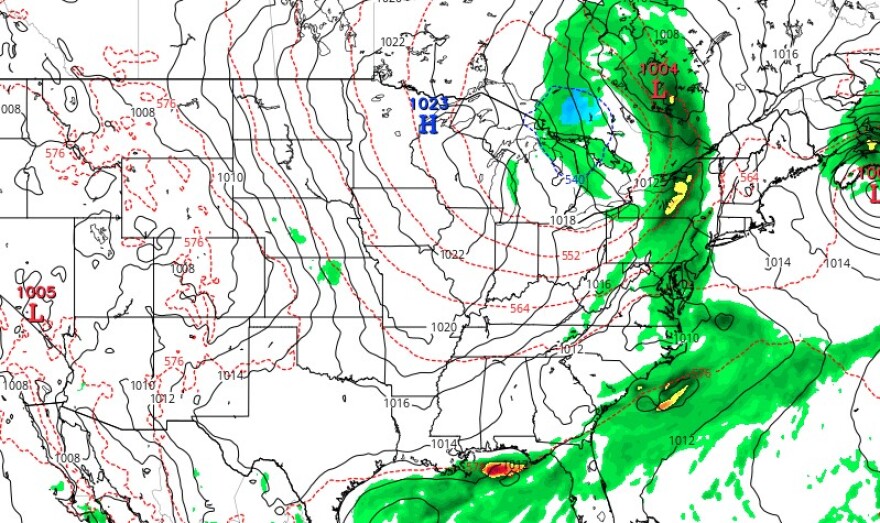
“High pressure centered close by will continue to dominate our weather through the near term,” the weather service said in its latest forecast discussion.
The end result is mainly clear skies and light winds leading to radiational cooling conditions, or the cooling of the Earth’s surface, especially due to lack of cloud cover.
Early Wednesday, the temperature dropped to 46 degrees in Allentown. It marked our coldest night since May 12, when the overnight low hit 45 degrees (just seven degrees shy of the day’s high temperature of 52).
Overall, there’s not too much change in the pattern for the next few days. The weather service expects a tranquil stretch with increasing clouds and an uptick in humidity through the end of the week.
What about the weekend?
If you’re keeping an eye on the forecast, you’ll hear a bit about phasing as it relates to a storm system coming up.
In weather terminology, phasing is when two low pressure systems combine into one low pressure system, creating a stronger and more intense storm.
Luckily, forecasters indicate that solution is apparently off the table for the Lehigh Valley this weekend and rain moving in won’t be that heavy.
“This is just going to be on Saturday,” EPAWA meteorologist Bobby Martrich said in his latest video update, while stressing that timing on these systems is “one of the last things decided definitively.”
Martrich said most guidance is consistent with having a shower break out late Friday night, with scattered showers Saturday morning.
But the heaviest rain should come later.
“Once we get into the afternoon, we’re going to see those showers evolve into steady periods of rain, which are going to go into the evening hours,” he said.
It’s all in association with the passing of a cold front that could bring a half inch of rain or a bit more to some areas, but again, it could've been worse.
A low-pressure system to our south is expected to move away off the coast rather than merge with our rainmaker.
Precipitation should exit by midnight Saturday, Martrich said, with a beautiful Sunday to follow with highs around 70 and mostly sunny skies on tap.
