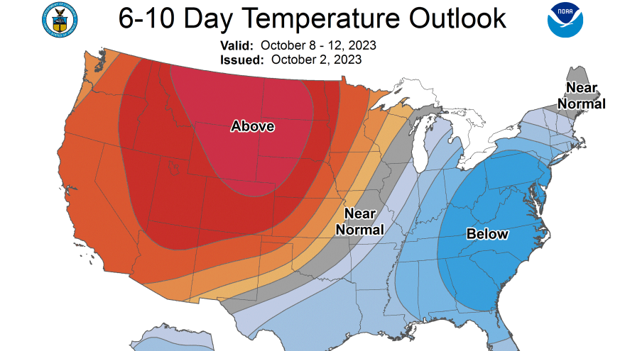
- Highs in the low- to mid-80s this week will fall off quickly this weekend
- Forecasters say a cold front will move through Friday into Saturday
- Some areas could see their first frost early next week
BETHLEHEM, Pa. — Quiet weather and warm temperatures will dominate the Lehigh Valley forecast this week, but big changes are in store this coming weekend.
That’s the word from the National Weather Service, which says mainly clear skies and warmer-than-average temperatures will continue over the next couple of days.
It’s all because of an expansive area of high pressure parked over the region expected to weaken and shift northeast later this week.
The Lehigh Valley hit 80 degrees on Monday — nine degrees above average for Oct. 2.
Temperatures are expected to hit the low- to mid-80s Tuesday and Wednesday, and the latest forecast discussion from the weather service calls Thursday “the last completely dry day of the week.”
“We’re going to have just a continuation of these conditions that are more suitable for early September rather than early October,” EPAWA meteorologist Bobby Martrich said in his latest video forecast.
“It’s not going to be oppressively hot, and the humidity levels are going to be moderate,” Martrich said.
Big changes ahead
EPAWA's 10/3 and week ahead outlook, covering:
— Bobby Martrich | EPAWA (@epawawx) October 3, 2023
■ Mostly sunny and very warm next couple of days
■ Cold front late week...a look at timing scenarios
■ Chilly air follows...first frosts for some possible?https://t.co/OPJBd9ZIv6
A mix of sun and clouds Thursday will yield to a cold front approaching the region, Martrich said, bringing the opportunity for scattered thunderstorms on Friday.
“The question is going to be timing of this frontal boundary,” Martrich said, noting guidance seems to favor that front moving across our area late Friday night and Saturday morning.
Martrich said those planning outdoor events on Saturday should continue to keep an eye on the forecast, with timing yet to be locked in for the arrival and departure of precipitation.
He said the current idea most favored is late-day showers and storms on Friday, which would continue overnight into Saturday.
“Then heading into Saturday morning we have a leftover shower before we have partial clearing,” he said.
“We’re leaning in that direction, but it doesn’t mean it’s going to exactly happen that way, and that’s going to impact some Saturday plans.”
‘Much cooler’ by Sunday
Daytime highs by Sunday are expected to be about 25 degrees cooler than they were earlier in the week.
The weather service said a gusty northwest wind may diminish a little Monday as it becomes more westerly.
High temperatures are expected to be in the 50s, and low temperatures each night down into the 40s — with the possibility of some mid- to upper-30s in the Poconos.
“As a matter of fact, we’re probably talking about our first frost in some areas as we get into early next week,” Martrich said.
“Maybe Sunday night into Monday morning and then again Monday night into Tuesday, especially in our far interior areas, so we’re going to watch that very closely.”
On average, the risk of frost for the Lehigh Valley area is from early October to early May. The Lehigh Valley typically sees it first frost/first freeze by Oct. 21.


