- A Facebook post spread like wildfire over the weekend, with a map depicting the Lehigh Valley buried under 40 inches of snow by Christmas
- The post was "wrong" and "without context," EPAWA meteorologist Bobby Martrich said
- "Just ignore this stuff, especially if it doesn't have context," he added
BETHLEHEM, Pa. — A Nov. 11 Facebook post showed a map of Pennsylvania and the surrounding mid-Atlantic region being walloped by snowfall in the weeks ahead.
“For those dreaming of a White Christmas, the latest European ensemble model has over 3 feet of snow falling during the 10 days leading up to Christmas,” the caption read.
The post had gotten more than 3,700 shares and nearly 500 comments by early Monday — some of them from meteorologists who said they now had to spend time answering questions about it in the middle of creating reasonable and accurate forecasts.
The map also was shared by businesses such as Blue Mountain Resort in Palmerton, which said on its post, “3 feet of snow leading up to Christmas?! Yes, please! You don’t want to miss this winter! Grab your season pass.”
‘Beware of Weenie Facebook posts’
“This is that time of year where I have to start talking about the Facebook posts,” EPAWA meteorologist Bobby Martrich said in his latest Weather Weeklies video (watch below), with the headline "Beware of Weenie Facebook posts" over top of the map.
Martrich said the Facebook post in question depicted the European weeklies, not the European ensemble.
Weather Weeklies video for Sunday November 12th is EPAWA's weekly editorial video blog, covering short and long term signals and the winter pattern for the entirety of the 2023-2024 season:
— Bobby Martrich | EPAWA (@epawawx) November 12, 2023
View it here~> https://t.co/UMcTNqEdQk
“This is not what the weeklies show, OK?" he wrote. "And somebody that shared this captioned this as being the Euro ensemble model and it’s not. It is the Euro weekly control.”
Martrich explained the weeklies go out to about six weeks in advance, and the control is one singular run out of 50.
For further context, the models run twice a week and “look” up to 46 days into the future, depicting snow, liquid precipitation, temperatures and low and high pressure anomalies.
“They cherry-picked this one [model] run to show all this snow,” Martrich said, also noting the original Facebook post highlighted the snowfall in the 10 days leading up to Christmas — another thing Martrich said wasn’t accurate.
“This is not a 10-day-before-Christmas forecast, this is a 32-day snowfall total, which would be between Nov. 22 and Dec. 24.”
He called the original Facebook post “wrong on both accounts” and shared “without context,” pointing out the Euro ensemble only goes two weeks into the future.
Are there increasing chances of snow?
The temperature dropped to 21 degrees in Allentown early Monday — one of the coldest nights so far this season. And, yes, there are increasing chances for snowfall — moreso in the northwestern areas of the region — in the weeks ahead.
Martrich called those spots “climatologically favored areas” showing the GFS — or American model — with a two-week lead depicting perhaps a shot at several inches of snow in places such as the Poconos.
“So just ignore this stuff, especially if it doesn’t have context,” Martrich said of the Facebook post making the rounds.
He predicted winter likely would get off to a slower start, and intra-seasonal patterns would dictate how the season plays out.
“In other words, you’re not going to have cold snaps that last weeks upon weeks,” he said. “It’s probably going to go up and down.”
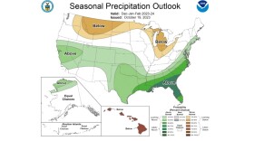
The government’s Climate Prediction Center said extended temperature outlooks — specifically those three to four weeks out — favor “enhanced probabilities of above normal temperatures” over much of the eastern United States, “supported by most of the dynamical temperature forecast tools.”


