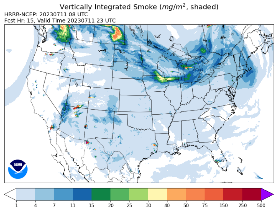
BETHLEHEM, Pa. — Mostly sunny skies on Tuesday may be dimmed slightly as another plume of Canadian wildfire smoke drifts over the region, the National Weather Service warned.
The smoke won't diminish air quality at the surface, but it will be noticeable in the atmosphere, creating a haze and dulling blue skies, the weather service said.
- The National Weather Service said mostly sunny skies on Tuesday may be dimmed slightly by wildfire smoke
- The smoke has drifted in and out of the region since early June
- It won't diminish air quality at the surface, but will dull blue skies
It will be the only negative in an otherwise seasonable and rain-free day.
Cloud cover should remain almost non-existent for the afternoon, the weather service forecast discussion said, letting dewpoints drop into the low 60s to upper 50s.
With temperatures expected to push into the upper 80s, it still should feel "quite pleasant" as relative humidity drops during peak heating, forecasters said.
Mostly sunny skies on Tuesday may be dimmed slightly as another plume of wildfire smoke moves toward us from Canada, as shown in this satellite loop from earlier this evening. The smoke is visible on the left, moving south over Lake Erie. pic.twitter.com/Rp5E7p1tYF
— NWS Mount Holly (@NWS_MountHolly) July 11, 2023
A new normal
Experts warned at the end of June that millions should prepare for rounds of wildfire smoke throughout the summer.
That warning came as the Canadian Interagency Forest Fire Centre reported 497 active fires burning across the country on June 30, with 229 out of control.
That day, acres burned by wildfires this season also surpassed 20 million.
On Tuesday morning, the agency reported 872 active fires in Canada, including 523 out of control.

The emissions from the wildfires so far this year is estimated to be the largest for Canada in more than two decades, according to a report from Copernicus, the European Union's Earth observation program.
Smoke or rain
The weather service said the main story in the short term will be the return of greater amounts of moisture moving into the region for the end of the work week.
An increasing southerly flow of air is expected to help funnel moisture in, and by Thursday morning surface dewpoints across the region are expected to approach 70 once again, making for oppressive heat.
Forecaster say a "moisture rich environment will provide the fuel necessary to develop some showers and thunderstorms across the area by Thursday afternoon."
It comes days after torrential rain triggered flash flooding across the region.


