BETHLEHEM, Pa. — It's not over yet.
After damaging winds tore through the Lehigh Valley on Tuesday, leaving thousands of residents without power, the Storm Prediction Center says another round of severe weather could be on the way Wednesday.
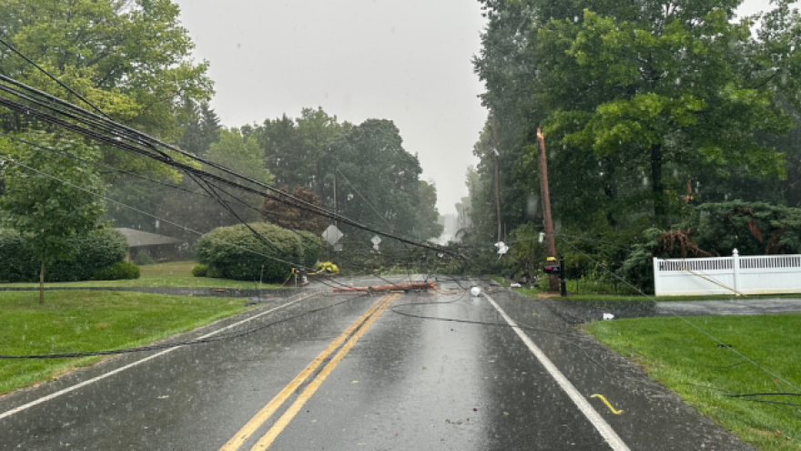
The National Weather Service reported wind gusts as high as 49 mph at Lehigh Valley International Airport as storms barreled through the region early Tuesday evening.
Wind and rain limited visibility on the roads, including parts of Interstate 78 from Bethlehem toward Center Valley. A tree fell across Lanark Road, snapping a utility pole and taking wires down with it around the same time.
Trees were reported ripped from the ground in the 200 block of 5th Street in Whitehall.
Outages to PPL Electric customers were mostly concentrated in places like Allentown, South Whitehall Township and Upper Saucon Township.
The weather service said on X it received "numerous reports" of wind damage across eastern Pennsylvania into North/Central New Jersey, with indication of severe downbursts and straight-line winds.
We have received numerous reports of wind damage across parts of eastern PA into north/central NJ. Radar data supports that several severe downbursts/macrobursts (straight-line wind) have occurred. Severe storms continue to move eastward. #pawx #njwx #dewx #mdwx
— NWS Mount Holly (@NWS_MountHolly) July 17, 2024
Early Wednesday, more than 1,700 PPL customers remained without power in Lehigh County, and about 75 were in the dark in Northampton County.
Met-Ed had about 75 customers without power in Northampton.
More severe weather ahead?
The SPC says isolated to severe storms are possible from the Carolinas all the way into New England on Wednesday, with a corridor of greater coverage from northeast Virginia into the Hudson Valley and adjacent southern Vermont/New Hampshire, and western Massachusetts.
That includes the Lehigh Valley, which is at a slight risk (2 out of 5) of severe weather, and where conditions "should support organized bands of storms capable of damaging gusts," the SPC said.
12:37am CDT #SPC Day1 Outlook Slight Risk: Across portions of the Mid-Atlantic and Northeast states https://t.co/TgJgC6cQZw pic.twitter.com/cLJwlXbSws
— NWS Storm Prediction Center (@NWSSPC) July 17, 2024
It comes with the area in its third consecutive day of an excessive heat warning, which remains in effect until 8 p.m.
"Expect to see many locations seeing heat index values over 100 by the afternoon," the weather service said in its latest forecast discussion.
"While cloud coverage and possible storms may limit temperatures from getting too out of hand, dew points will likely increase a bit and linger in the low 70s during the afternoon hours, leading to continuing oppressive heat," the discussion said.
Timing
The weather service said a slow-moving cold front "will create a marathon of severe weather and hydro concerns beginning early afternoon through at least the evening hours into the overnight."
It said "abundant instability" and precipitable water values "will fuel the potential for training thunderstorms across the region."
The Lehigh Valley could see storms in the afternoon, expected to concentrate north and west of the I-95 corridor, after 2 p.m.
Scattered thunderstorms are expected to continue through the first half of the night ahead of the advancing cold front.
Storms should eventually give way to residual showers before tapering off, the latest forecast discussion said.